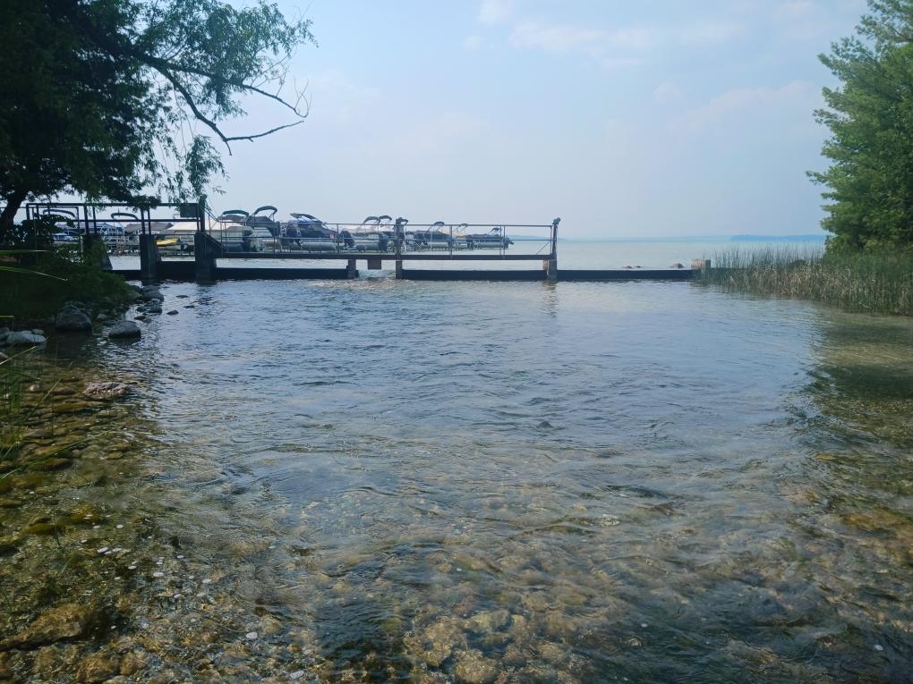
Higgins Lake Level Control Structure 2023 Engineering Report
This report is a combination of history, qualitative analysis of dam condition, and a discussion of future project options for consideration by the Roscommon County Board of Commissioners. They are as follows:
- Do Nothing
- Minor Improvements
- Major Improvements
- Replace existing structures
A slide presentation with discussion by Spicer Engineers covers these options below:
https://www.roscommonlakelevels.net/post/higgins-lake-llcs-engineering-webinar
Higgins Lake Level Control Structure 2010 Engineering Report
Lake Level Resolutions:
The following resolution regarding the County’s management of the Cut River Dam and the Legal (Summer) Lake Level was approved by the HLPOA Board on October 15, 2018 and presented to the County Board of Commissioners. The Higgins Lake Land Conservancy (HLLC) authored/presented an identical resolution. The resolution requests the County adopt the 2010 Spicer Group recommendations for modifying and managing the Cut River Dam to better maintain the legal lake level throughout the summer months.
Higgins Lake Level — Data Gathering:
Every fifteen minutes a submerged pressure gauge in Higgins Lake reads the pressure due to the height of water/ice above the gauge, converts this pressure to a lake level reading and sends the data to a United States Geologic Survey (USGS) office. Click on the link below to visit the USGS website for Higgins Lake.
- USGS Higgins Lake Level Daily Averages Chart
- Higgins Lake Daily Average Lake Level Chart 2025
- Higgins Lake Daily Average Lake Level Chart 2024
- Higgins Lake Daily Average Lake Level Charts 1978 – 2023
- June thru Sept Average Lake Level v Legal Level – 1979 to 2024
Lake level data for any period of time can be obtained by entering the desired dates in the date fields on the USGS website. All of the lake level data used to create the series of charts in the list, above, came from the USGS website.
Cut River Flow Rate — Data Gathering:
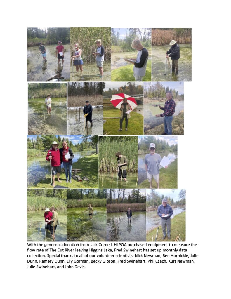
Teams of volunteers are measuring the flow rate in cubic feet per second for The Cut River at a fixed location approximately 100′ below the Roscommon County Road 100 river crossing. The data will be posted by month and year graphically. The water velocity ismeasured with a Global Water Company FP111 flow meter.

Flow Rate Measurement in The Cut River January – February 2025
Flow Rate Measurement in The Cut River June 2023 – January 2025
2015 – Ecohydrologic Evaluation of Removing the Higgins Lake-Level Control Structure
The 2016 Final Report to the Muskegon River Watershed Assembly, entitled the “Ecohydrologic Evaluation of Removing the Higgins Lake-Level Control Structure”, focuses on the effects of Higgins Lake and Cut River water levels on the local sport fishery.
“In the context of ongoing discussions of water level management in Higgins Lake, the impact of changing water surface elevations on fish and the regions valuable fishery have been largely overlooked. This study provides Michigan Department of Natural Resources with the first quantitative analysis of the relationships between managed lake elevation and fish habitat features, both in Higgins Lake proper and in the downstream Cut River channel. Based on responses of habitat suitability models to changes in water level and discharge to the Cut River, we draw the following conclusions:
- The range in the water level targets currently being discussed for Higgins Lake are small enough that none of the scenario levels, including dam removal, are likely to substantially change habitat conditions for the lake fishery.
- In contrast, the Cut River appears to be quite susceptible to low flow disturbance and discharge. The Cut River is quite sensitive to variations in both outlet configuration and Higgins Lake water surface elevation.
- Based on the RAS (US Army Corps of Engineers River Analysis System) modeling for the study reach and subsequent WUA (Weighted Usable Area) analysis, a minimum 50 cfs seems a reasonable target flow rate to protect downstream fishery values.
- Flows of 100-150 cfs are likely necessary to provide optimal habitat for key species.”
The entire report is linked below:
2015 Dam Study UofM Wiley and Layman
Glacial Lake Roscommon:
The first link, below, is to an article published in the Houghton Lake Resorter on “Glacial Lake Roscommon” that appeared in the July 5, 2018 issue of the newspaper. It documents the existence of a very large lake, encompassing Higgins Lake, Houghton Lake and Lake St. Helen, that was created approx. 20,000 years ago, as the last Ice Age waned in Michigan. A team of scientists from MSU, Univ. of Cincinnati, Univ. of Illinois and North Dakota State Univ. have theorized this ancient lake, at one time, may have covered an area twice the size of Roscommon County. The second link, below, is the scientific paper published by MSU Professor Randall Schaetzl, et al, that was the basis of the HL Resorter article.
- Glacial Lake Roscommon – HL Resorter July 5, 2018
- Michigan State Univ – Glacial Lake Roscommon Paper
1921 Michigan Geological & Biological Survey — Higgins Lake, et al:
Below is a link to a 1921 report published by the State of Michigan Geological and Biological Survey. The discussion of Higgins Lake begins on page 18 of this report and it describes the geological formation of the lake, providing factual information on the lake’s level over the thousands of years after the Ice Age ended. As the article states, at one point in time many thousands of years ago, the lake level stabilized at 16 feet above today’s level. Several thousands of years later, as the ground continued to rebound without the weight of a mile or more thickness of ice covering it, the lake level stabilized again at about 8 feet above today’s level. After several thousand more years, it stabilized at 2 feet above today’s level for a period of time before it eventually stabilized at today’s level. When reading about Higgins Lake in this nearly 100 year old report, familiar landmarks mentioned therein had different names assigned to them, as follows:
- Chicago Point is now known as Point Detroit
- State Forest is an area of the lake in Crawford County
- Saginaw Grounds/Bay City Grounds area is now known as Lakeside/Cottage Grove/Pinewood
- Cole is an area located on the north end of what is now known as Pine Bluffs
- Parker Point, former site of the old Parkers Hotel, is now known as Flag Point
- Highland Point includes an area now known as Almeda Beach
The existence of credible scientific information such as the above article on Glacial Lake Roscommon and the Michigan Geological and Biological Survey Report of 1921 shed new light on the oft-debated topic of: “What is the natural level of Higgins Lake?”
Court Orders Defining the Legal Lake Level:
The legal level for Higgins Lake is 5.37 ft. gauge height (or 1154.11 ft. above sea level), set by the Michigan Circuit Court in 1926. In 1982 the Circuit Court established a legal winter lake level, not to exceed a decrease of more than 6 inches below the legal (summer) level. This represents a gauge height of 4.87 ft. (or 1153.61 ft. above sea level). Subsequently, in 2009, the Circuit Court ordered the legal winter level to be decreased an additional 3 inches for a trial five year period, which expired in the spring of 2014, to help mitigate shoreline ice damage. These Court Orders are listed below:
- 1926 Circuit Court Order Establishing the Natural Height and Level of Higgins Lake.
- 1982 Circuit Court Order Establishing the Winter Level 6″ Below the 1926 Legal Level.
- November 2009 Court Order Establishing a Temporary 5-Year Add’l 3″ Lower Winter Level, from 2009 thru 2014.
The outflow of water through the Cut River Dam at Higgins Lake, and hence the lake level, is managed by the Roscommon County Board of Commissioners. The Circuit Court directive for the control of the lake level is to begin lowering it to the legal winter level on November 1st, and begin restoring it to the legal (summer) level on April 15th or ice-out, whichever occurs first.


